Proven in the field
Selected work for utilities, municipalities and government, from satellite change detection to field verification.
uMngeni-uThukela Water DRES
The Disaster Risk Encroachment Solution (DRES) is an end-to-end solution for combating servitude encroachment on uMngeni-uThukela Water infrastructure. Built on Esri ArcGIS, it monitors hundreds of kilometres of high-pressure pipeline servitudes so new structures are found early, before they restrict access, damage pipes or endanger communities.
- 1Detect. Encroachments detected using remote sensing and change detection.
- 2Track. Incidents displayed on monitoring and tracking dashboards tailored to each role.
- 3Verify. Field teams confirm each incident with a mobile verification app.
- 4Decide. Real-time decision-making and reporting for prompt intervention.
Chatsworth floods, April 2022
SkySat imagery captured on 28 March and 15 April 2022 shows how the April 2022 KwaZulu-Natal floods changed the Mlazi River in Chatsworth. The river burst its banks and stripped vegetation along the floodplain, beside homes and roads.
Before-and-after imagery like this lets municipalities and utilities assess damage quickly, prioritise inspections and plan recovery, without waiting for ground surveys.
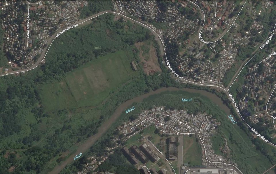
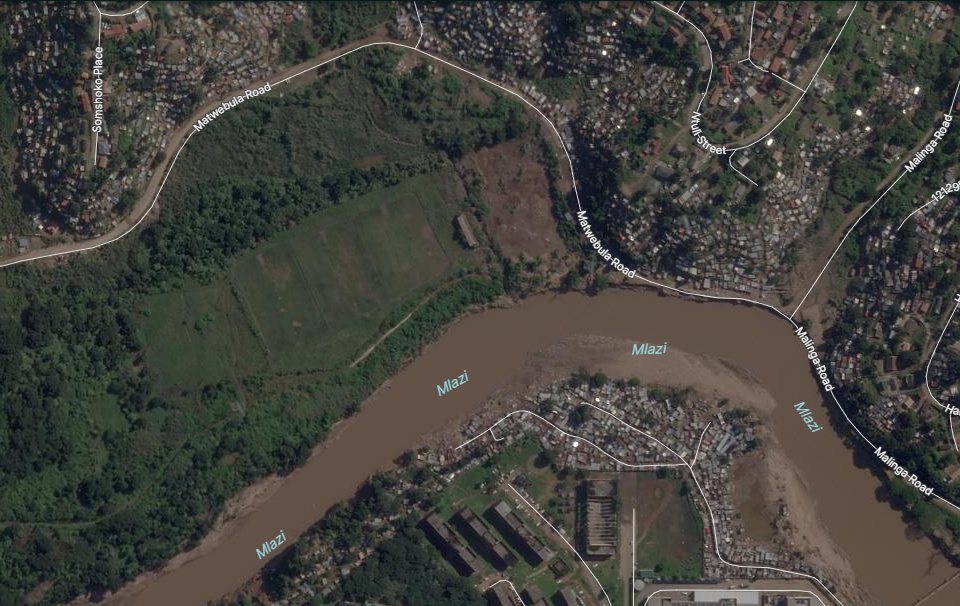
SkySat satellite imagery of the Mlazi River, Chatsworth, eThekwini. Imagery © Planet Labs PBC.
More results
City of Tshwane leak pilot
16 leaks confirmed in 2 field days on a 500 km pilot using satellite-assisted leak detection.
Rand Water
40 leaks identified through satellite-assisted detection and ground confirmation.
Who we work with
 uMngeni-uThukela Water
 Department of Public Works and Infrastructure
 eThekwini Municipality
 Dube TradePort Corporation
 KwaZulu-Natal Office of the Premier
 Rand Water
Let's talk
Tell us about your network, corridor or project and we'll show you what the data can do.