
Capabilities that span sectors
From utilities and municipalities to defence, agriculture and energy, SIS delivers integrated geospatial, software and consulting solutions that give real-time insight, smarter decisions and sustainable growth.

Enterprise software
- Enterprise-grade platforms and applications
- Streamlined processes and automation
- Integrated with your GIS and spatial data
Consulting and advisory
- Sales enablement and sales force optimisation
- Business intelligence strategy and analytics
- Channel and partner network development
- Win/loss analysis and performance reviews
Geographic Information Systems
- Esri South Africa partner
- Utility mapping, logistics, asset tracking
- Municipal planning
- ArcGIS dashboards, Field Maps and Survey123
Satellite monitoring and imagery
- Global imagery up to 30 cm, with Earth Data Analytic Enterprises
- Secure cloud platform; Esri shapefiles and KML
- Disaster monitoring, water resource tracking, infrastructure development
Defence, intelligence and government
- High-frequency Earth Observation imagery
- Situational awareness and reconnaissance
- Change detection and infrastructure surveillance
- Full-motion video and hyperspectral imaging
- Confidential, secure end-to-end data delivery
Agricultural monitoring
- Crop health and yield prediction
- Soil moisture and land use monitoring
- Vegetation index tracking and analysis
- Support for regulatory planning, compliance and insurance reporting
Energy and infrastructure monitoring
- Semantic change detection of roads, pools, pipelines and machinery
- Regular inspections and hazard alerts for oil and gas pipelines
- Environmental compliance: vegetation recovery and reclamation validation
- Event management for natural disasters and remote infrastructure failures
- Supply chain monitoring: yield forecasting, provider comparison, compliance tracing
Chatsworth floods, April 2022
SkySat imagery captured on 28 March and 15 April 2022 shows how the April 2022 KwaZulu-Natal floods changed the Mlazi River in Chatsworth. The river burst its banks and stripped vegetation along the floodplain, beside homes and roads.
Before-and-after imagery like this lets municipalities and utilities assess damage quickly, prioritise inspections and plan recovery, without waiting for ground surveys.
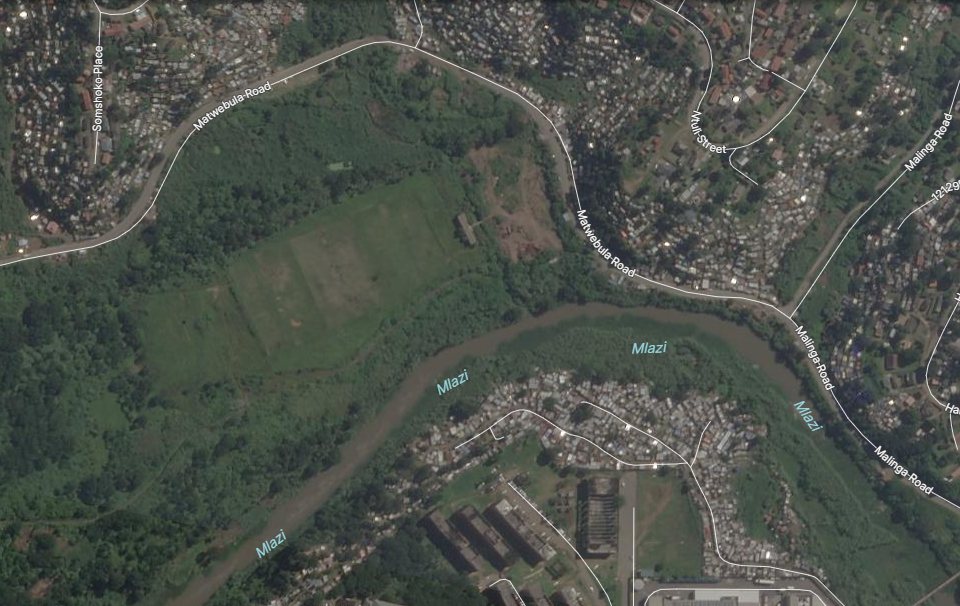
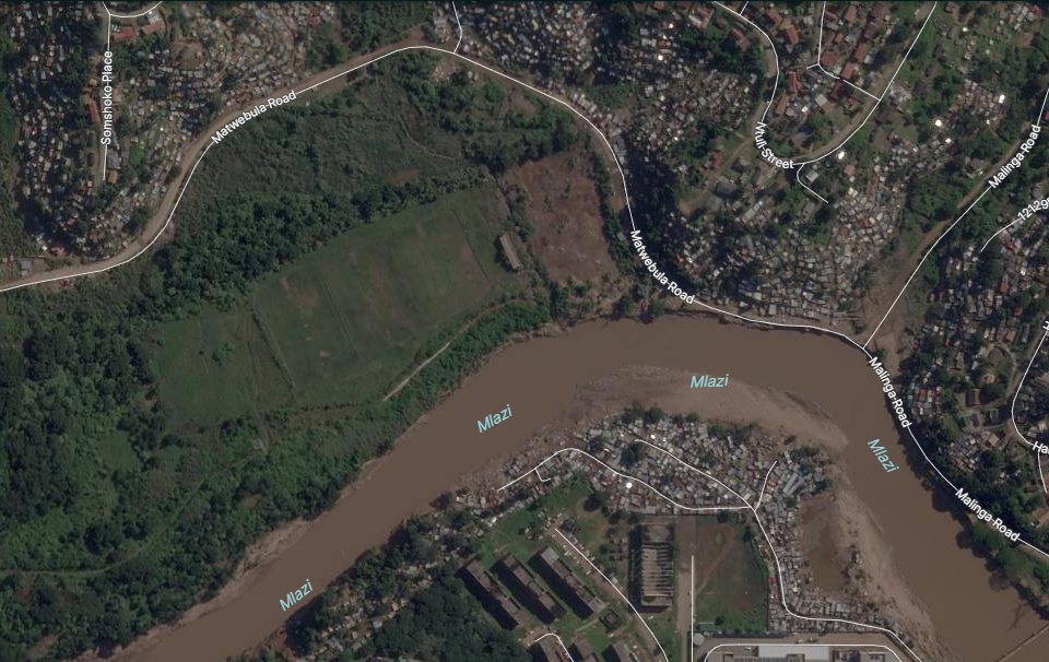
SkySat satellite imagery of the Mlazi River, Chatsworth, eThekwini. Imagery © Planet Labs PBC.
Let's talk
Tell us about your network, corridor or project and we'll show you what the data can do.